Foto:
Piste Information
Find maps and details about Rauland’s slopes, trails, and other facilities:
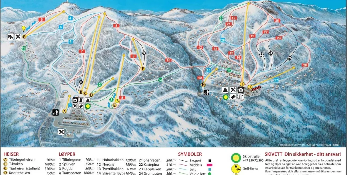
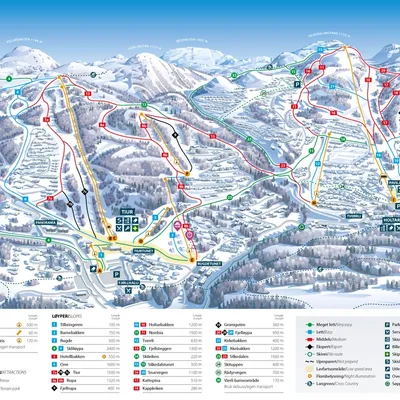
🎿 Rauland – Ski Area Overview
📍 Location: 243 km from Kristiansand • 700–1,140 meters above sea level
🎿 Alpine Slopes
About 20 km of slopes in total across green, blue, red, and black runs 26 runs altogether • Longest run approx. 3 km Several illuminated trails for evening skiing
🚡 Ski Lifts
11 lifts in total – 2 chairlifts • 8 platter lifts • 1 T-bar lift Lift capacity: approx. 13,000 people per hour
❄️ Cross-Country Skiing
Roughly 150 km of trails – 80 km in forest areas • 70 km in the highlands Groomed and partially illuminated routes • Beautiful Telemark scenery
👨👩👧👦 Families and Children
Children’s area with conveyor belts and platter lifts Sledding hill for the youngest • Gentle beginner terrain
🏂 Other Facilities
Terrain park • Fun park • Snowboard school Ski school • Ski rental • On-slope dining • Après-ski
📎 Information is subject to change. For current conditions, slope maps, and webcams, visit raulandskisenter.no.
Look around
Location
Rjukanvegen 1066, 3864 Rauland, Norge
Reviews
Loading...